UCLA Library
ArcGIS, QGIS or web apps can simply use this map with web map services. WMTS, TileJSON or XYZ tiles are provided for quick access to processed maps.
Sign in to get links.
Sign in to download GeoTIFF.
Overlay & compare
iiif viewer, iiif info json
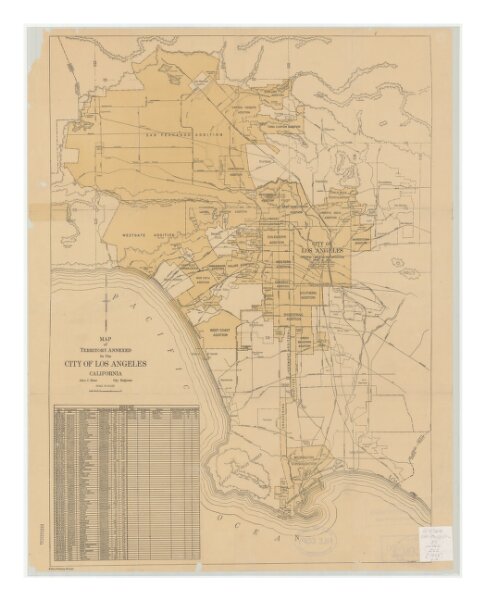
Map showing territory annexed to the city of Los Angeles, California
21198_zz002c22xg
California
Includes chart showing history of annexed territory, numbered 1-83. "Mar. 14, 1935"--Last line of history chart.
1935
Lloyd, Aldrich, 1886-1967
[Los Angeles, Calif. : City Engineer]
35 × 25 cm
1 : 1225000