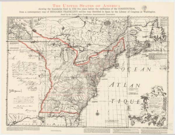
The United States of America, showing the boundaries fixed in 1782, five years before the ratification of the Constitution : from a contemporary copy of Benjamin Franklin's red-line map identified in Spain by the Library of Congress at Washington.
ArcGIS, QGIS or web apps can simply
use this map with web map services.
WMTS, TileJSON or XYZ tiles
are provided for quick access to processed maps.
Sign in to get links.