UCLA Library
ArcGIS, QGIS or web apps can simply use this map with web map services. WMTS, TileJSON or XYZ tiles are provided for quick access to processed maps.
Sign in to get links.
Sign in to download GeoTIFF.
Overlay & compare
iiif viewer, iiif info json
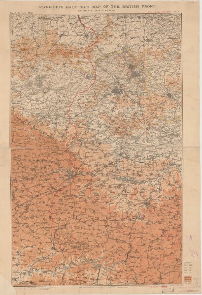
Stanford's half-inch map of the British front in France and Flanders
21198_zz002cfh6t
Europe
Shows line of battle in June 1916 and updated line of battle in June 1917.Relief shown as gradient tints.Shows: railways, roads, woods.
1917
Edward Stanford Ltd.
[London] : Edward Stanford Ltd.
97 × 61 cm
1 : 126720