UCLA Library
ArcGIS, QGIS or web apps can simply use this map with web map services. WMTS, TileJSON or XYZ tiles are provided for quick access to processed maps.
Sign in to get links.
Sign in to download GeoTIFF.
Overlay & compare
iiif viewer, iiif info json
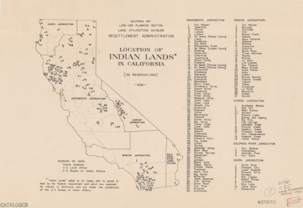
Location of Indian lands in California (132 reservations).
21198_zz002bfrm0
California
Includes index of reservations by jurisdiction.
1936
United States. Resettlement Administration. Land Utilization Division. Land-Use Planning Division. California Unit
27 × 39 cm