UCLA Library
ArcGIS, QGIS or web apps can simply use this map with web map services. WMTS, TileJSON or XYZ tiles are provided for quick access to processed maps.
Sign in to get links.
Sign in to download GeoTIFF.
Overlay & compare
iiif viewer, iiif info json
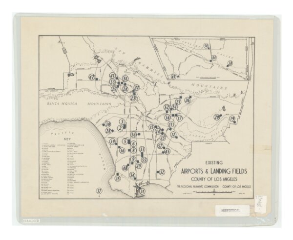
Existing airports & landing fields, County of Los Angeles
21198_zz002c1j1b
California
Includes inset of north part of Los Angeles County and index.
1931
Los Angeles County (Calif.). Regional Planning Commission
[Los Angeles, Calif.] The Commission
36 × 47 cm
1 : 1250000