UCLA Library
ArcGIS, QGIS or web apps can simply use this map with web map services. WMTS, TileJSON or XYZ tiles are provided for quick access to processed maps.
Sign in to get links.
Sign in to download GeoTIFF.
Overlay & compare
iiif viewer, iiif info json
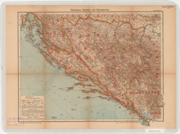
Dalmatien, Bosnien und Hercegovina. Sonderkarte 4
21198_zz002cf1b4
Europe
Relief shown by hachures and spot heights. Depths shown by isolines and soundings. Shows cities with populations, villages, main roads, railroads, forts and fortresses, beacons and telegraph lines. Language German
1914
Velhagen & Klasing
Bielefeld and Leipzig: Velhagen & Klasing
40 × 50 cm
1 : 1000000