UCLA Library
ArcGIS, QGIS or web apps can simply use this map with web map services. WMTS, TileJSON or XYZ tiles are provided for quick access to processed maps.
Sign in to get links.
Sign in to download GeoTIFF.
Overlay & compare
iiif viewer, iiif info json
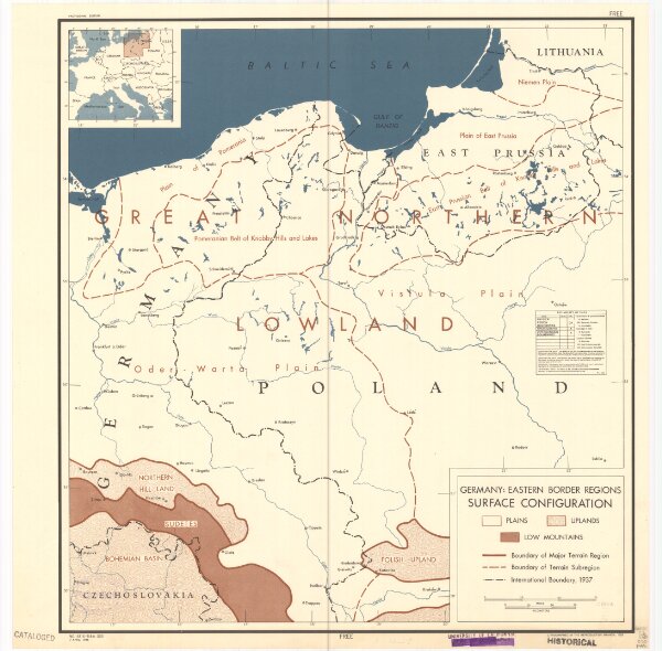
Germany, eastern border regions surface configuration
21198_zz002cz1nh
Europe
Relief shown by gradient tints. Includes most of western Poland. Includes location map.
1945
United States. Office of Strategic Services. Research and Analysis Branch.
[Washington, D.C.] : R & A, OSS
50 × 47 cm