UCLA Library
ArcGIS, QGIS or web apps can simply use this map with web map services. WMTS, TileJSON or XYZ tiles are provided for quick access to processed maps.
Sign in to get links.
Sign in to download GeoTIFF.
Overlay & compare
iiif viewer, iiif info json
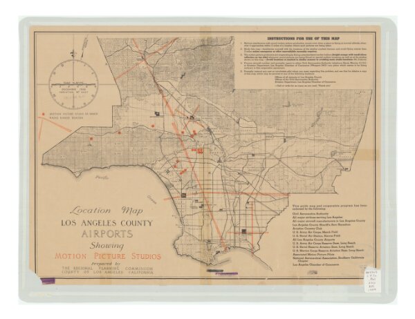
Location map, Los Angeles County airports, showing motion picture studios
21198_zz002c1kc0
California
Relief shown by hachures and spot heights. Includes text.
1939
Regional Planning Commission, County of Los Angeles, California
[Los Angeles, Calif.] The Commission.
41 × 57 cm
1 : 1220000